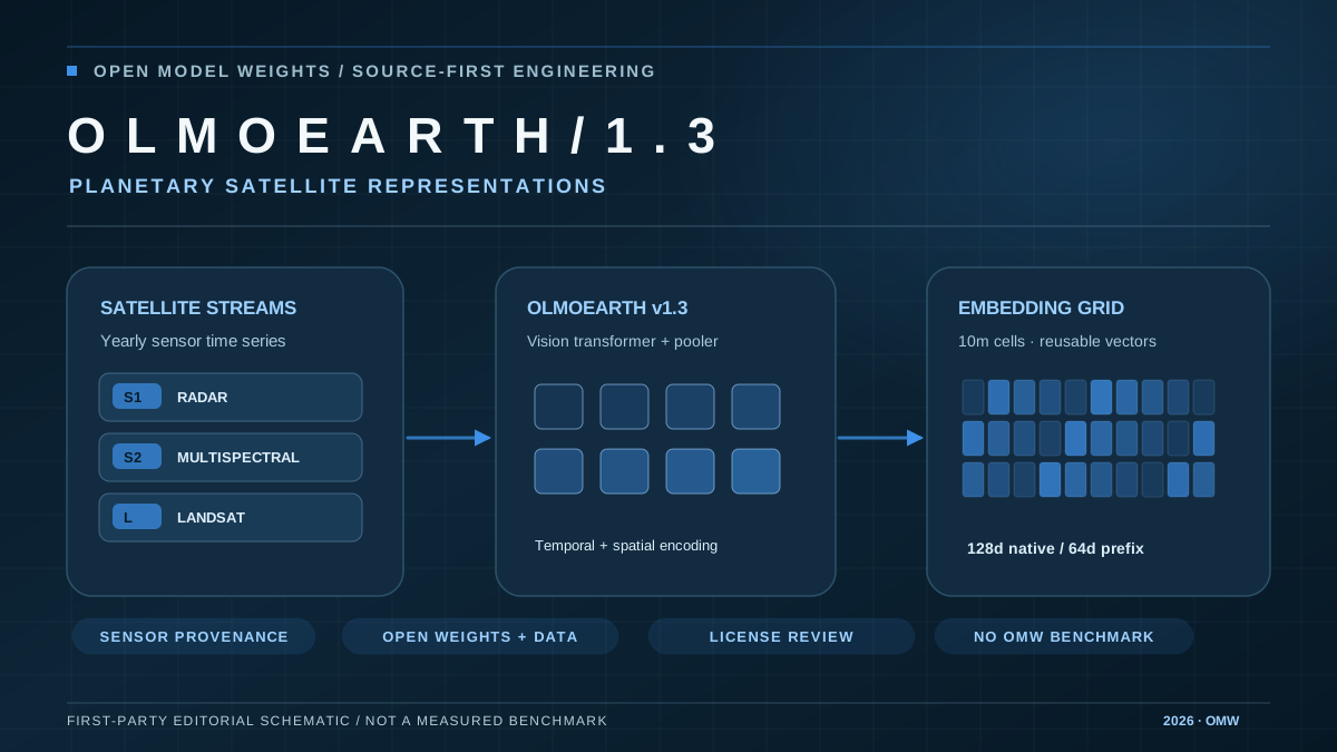
The Allen Institute for AI has released OlmoEarth v1.3, a geospatial foundation model and a set of annual embeddings computed across the planet. Unlike a general-purpose chatbot, OlmoEarth turns satellite time series into compact representations for downstream tasks such as land-cover mapping, crop analysis and change detection. Along with the downloadable Base checkpoint, Ai2 supplies the OlmoEarth Embeddings Explorer and data access paths. The major contribution is reusable public representations: teams can train smaller task-specific models without continually reprocessing raw multi-sensor imagery.
OlmoEarth v1.3 draws on Sentinel-1 radar together with Sentinel-2 and Landsat multispectral observations. A vision transformer and attention pooling produce a 128-dimensional feature vector per 10-meter pixel, with the first 64 dimensions also designed for use as a smaller representation. Ai2 reports approximately 150 TB of embeddings per year. At launch, the years 2023 through 2025 are global, while 2017 through 2022 cover selected countries. These are data-availability statements, not a guarantee that every historical place or sensor scene exists.
The project's own evaluation compares OlmoEarth with AlphaEarth Foundations and Tessera v2 across 27 tasks. Ai2 reports top performance on 20 of those tests using 128 dimensions and 18 tests with the 64-dimensional variant. Those are author-run comparisons, not independent Open Model Weights benchmarks. The provider also reports cheaper training than previous OlmoEarth versions. Published tile-level provenance enables auditors to identify the original satellite scenes behind embeddings, but map predictions must still be checked against reliable local ground truth.
For developers, the practical workflow is to select a geographic region and year, download the matching embedding tiles, label a small set of representative examples and evaluate a classifier while accounting for spatial leakage and seasonal shifts. The interactive explorer can help identify errors and export geospatial layers, but visual patterns alone are not causal proof of deforestation, crop type or illegal activity. The weight, data and code releases use the OlmoEarth Artifact License; organizations should review its terms rather than inferring an unrestricted Apache grant.
What this changes for the evidence layer
OlmoEarth v1.3 is a separately released geospatial checkpoint and embedding dataset; verify exact SHA, full checkpoint availability, evidence and OlmoEarth Artifact License before adding a canonical model record.
Ai2 official OlmoEarth v1.3 release and technical overview
This brief is based on the cited primary source. Performance, benchmark and comparative claims remain attributed unless Open Model Weights publishes an independent measurement.
Open source article ↗